Mark Allyn's Videos of Bicycling Around Bellingham, Washington
I have been informed that many people do not use social media or use it very little. Because I
want to reach out to as many as possible, I have established this website to hold links and
descriptions of all of my Bellingham bicycling related videos. I will only announce this website's
locations on my social media accounts including Reddit and facebook. I will not be putting
my video directly on social media.
Please be aware that this site is my own and there is no tracking software nor are there any
advertisements.
Please, if you wish, you may pass this around. Just use the name bicyclebellingham.com
Please also be aware that all of my new videos are on Vimeo and will have
players here. However, older videos on Youtube will have only links.
Please, if you have any suggestions or comments, email me at allyn@well.com
Safe Route From Whatcom Falls Park To Downtown Bellingham
This is a safe route from Whatcom Falls Park or Bayview Cemetary to Downtown
Bellingham using a safe flass trail and some streets. It does not use Lakeway and
it is quicker than using the Railroad Trail
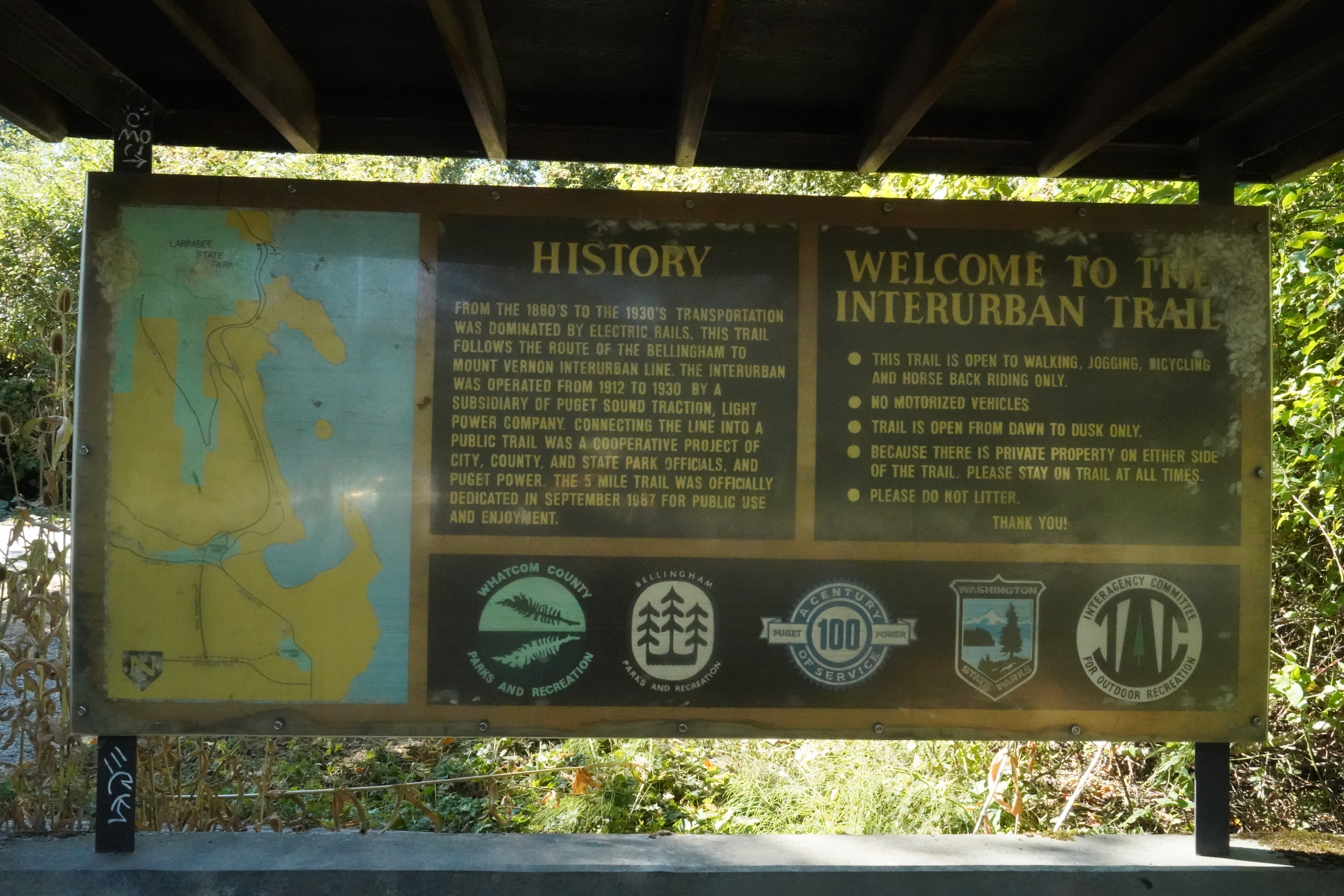
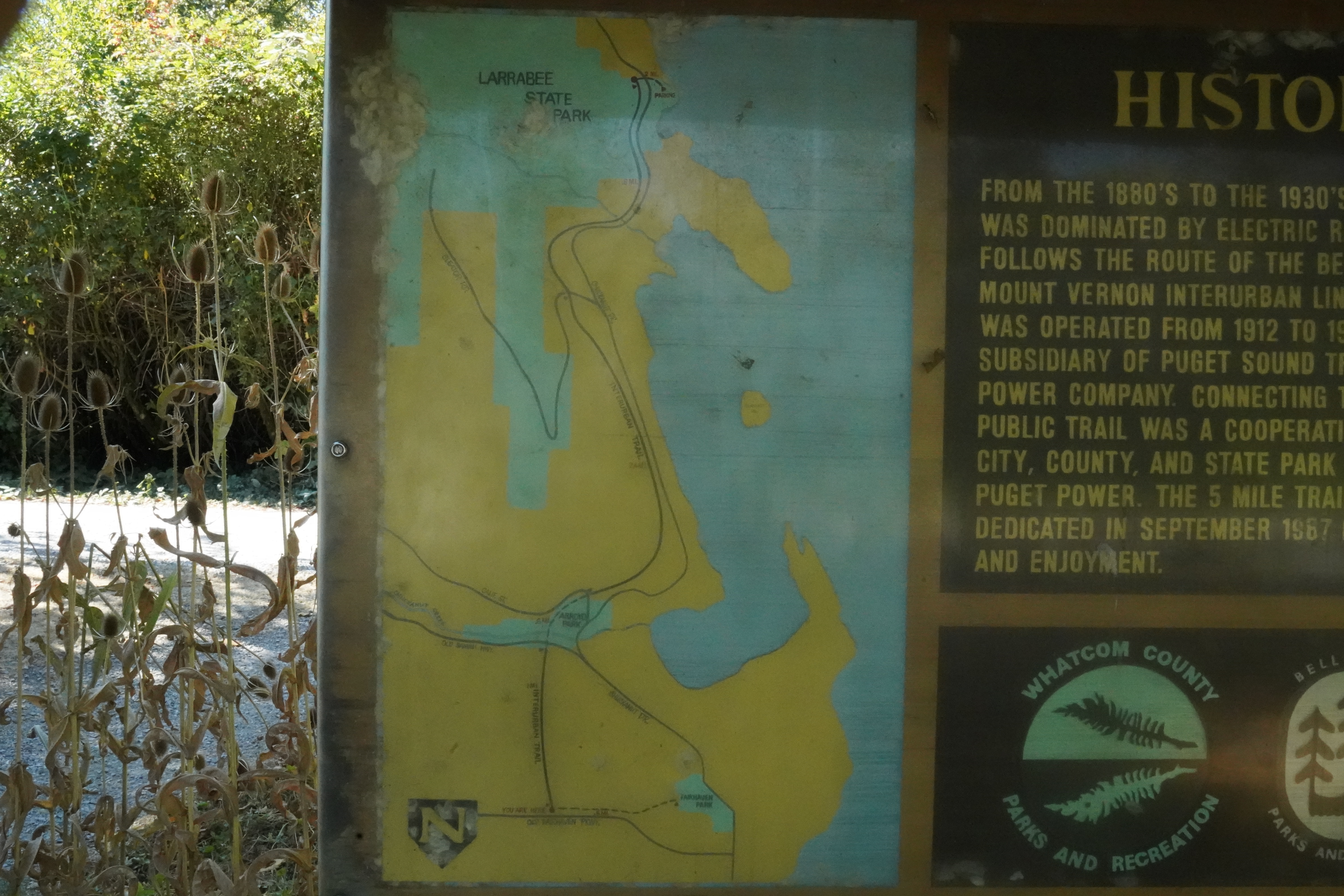
The Interurban Trail
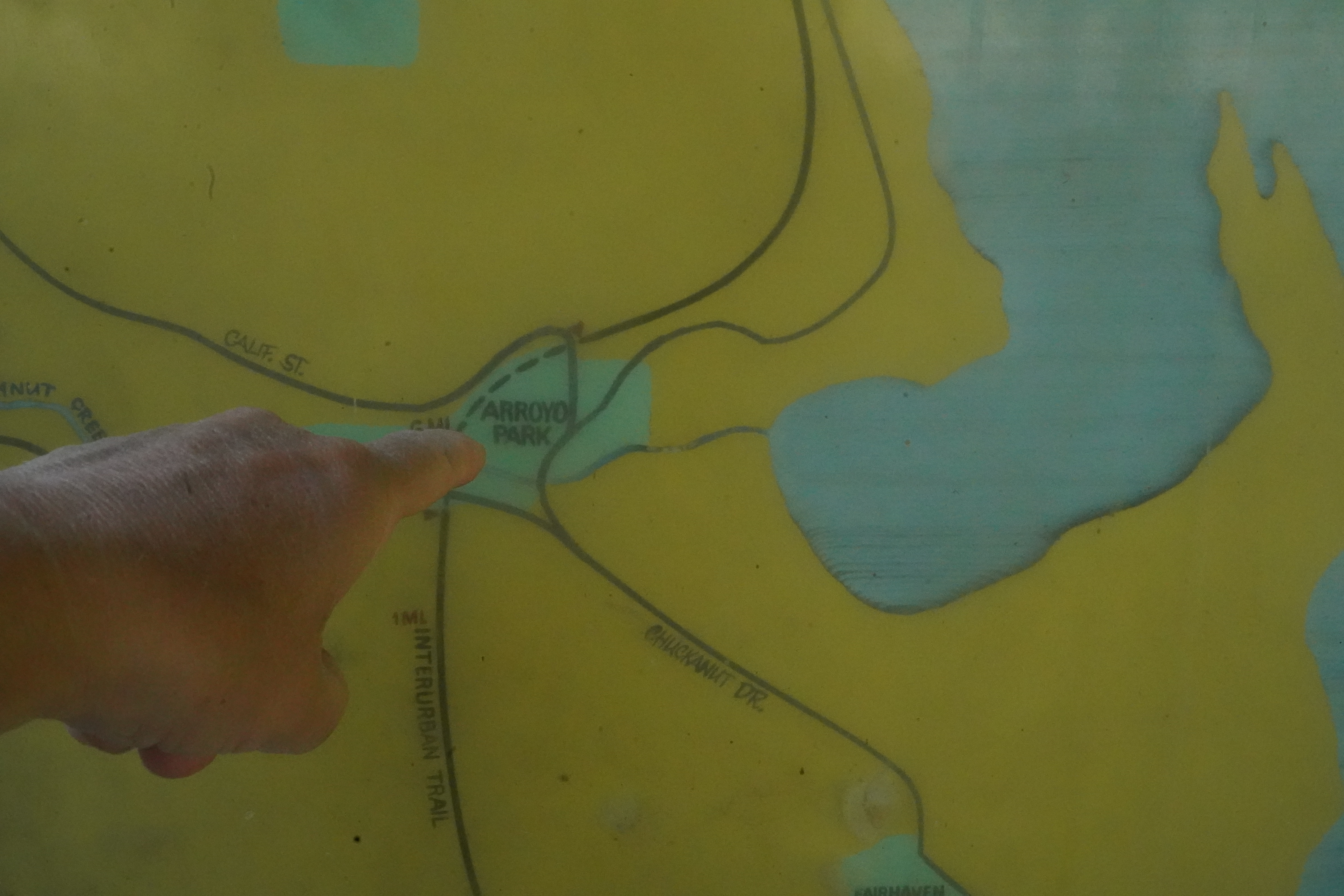
Folks: In case you did not know, there is an un-marked detour of the Interurban Trail between the segment of the trail from
Fairhaven to Arroyo Park and the segment from Arroyo Park to Larrabee State Park. Inside Arroyo Park there is a bridge that
needs repair and that is closed. You have to detour on Old Samish Road, Chuckanut Drive, and California Street.
With this video, I will be performing a detailed narrated tour of the trail, starting from the Taylor Dock in Fairhaven to
the intersection of the Interurban Trail at California Street.
Photographs Of Interpretive Signs
Signs As Old Fairhaven Drive In Trailhead
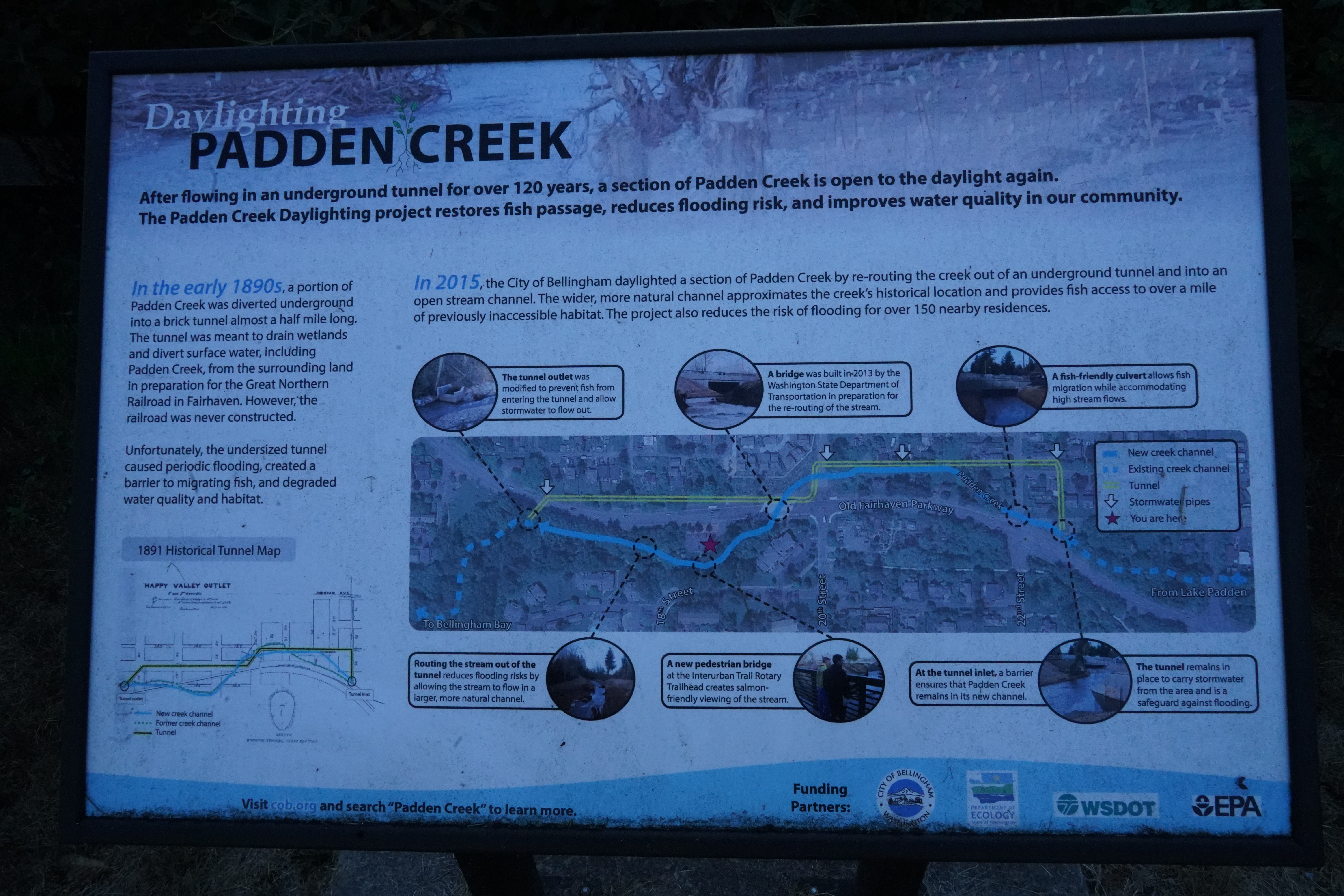
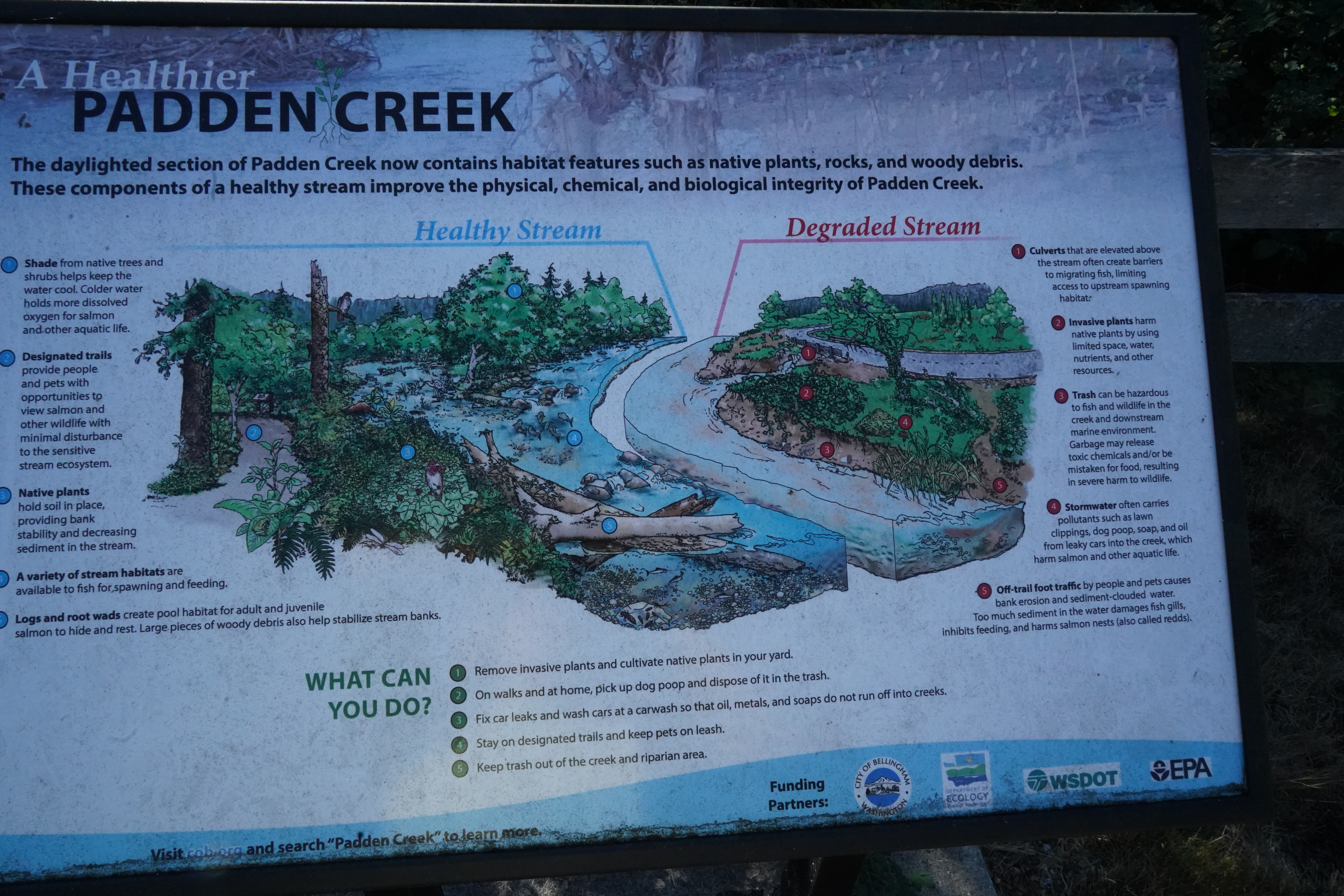
Map Sign At Old Fairhaven Walk In Trailhead
Bicycle Tour Of Five Parks in Bellingham And Along Chuckanut Road
This is a very long and challenging tour if you perform this tour in one day. You can take parts of this tour. I have put the times for each park at the beginning of the video. Here are the time; the GPS locations, and links to the google maps for each of the parks.
Boulevard Park
Boulevard Park is perhaps the single busiest park here in Bellingham. It is small, but it is right on the water with wonderful spectacular views. Parking if a big challenge; this is why bicycling to Boulevard Park is ideal and very pleasent.
GPS = 48.732851, -122.501119
Time Mark In Video - 5:50
Marine Park
Marine Park is a small park that is right on the water. It is at the end of Harris Avenue in Fairhaven. Marine Park is the official finish line for the annual Ski To Sea race.
GPS = 48.719515, -122.514696
Time Mark In Video - 12:30
Fairhaven Park
Fairhaven Park is located on Chuchanut Drive (as well as the Fairhaven link of the Interurban Trail. It is a simple park with a playgroun, tennis courts, and a shelter. There is a small building available for events.
GPS = 48.715265, -122.499301
Time Mark In Video - 18:50
Woodstock Farm
Located on Chuckanut Drive, south of Fairhaven Park, Woodstock Farm is perhaps one of the most undiscovered parks in the Bellingham Parks And Recreation System. This was the private estate of Cyrus Lester Gates, who was a Fairhaven capitalist, park creator and civic leader from 1890 to 1927. The house is available for rental for functions. It is a very wonderful place for weddings! The outdoor areas of the estate are open to the public during the daytime.
GPS = 48.697951, -122.495387
Time Mark In Video - 22:00
South Part Of Interurban Trail
Unfortunately, it is not possible to stay on the Interurban Trail from Fairhaven all the way to Larrabee Park. The Interurban Trail is currently interrupted by a collapsed bridge over a creek in Arroyo Park. The easiest way to get onto the southern part of the Interurban Trail is via California Street, a dead end street on the east side of Chuckanut Drive about 1 mile north of Wookstock Farm.
48.699000, -122.490069
Time Mark In Video - 27:00
Larrabee State Park
Located on Chuckanut Drive, in the very southern end of Whatcom County, Larrabee State Park is a State Of Washington Park. This park does have camping facilites. Reservations are strongly recommended for camping. Respecting the privacy of the campers, my video only has a small brief look at a part of the camping area. As a State Park, Larrabee Park does have an admission fee for vehicles, of you can use the Washington Start Parks Discover Pass. Please note, however that there is no fee for pedestrians or people on non motorized transportation such as bicycles or horses who come into the park for a day trip.. There is, of course, a fee for camping.
GPS = 48.653102, -122.490096
Time Mark In Video - 31:50
Bicycle Ride To Waterfront For New Conference Center
I just could not resist putting in my suggestion for the design of the proposed conference
center that will be located in the Boardmill Building on the former Georgia Pacific site here
in Bellingham!
And the Gods of Wisdom have suggested to the Port Of Bellingham that the Port should invite the Centers For Disease Control to host it's Prostate Cancer Symposium as the inaugural event for the new conference center when it opens!
Bicycling Railroad Trail And Talking about Covid And Aids
Older Videos On Youtube
allyn (at) well.com